REVIEW · AMSTERDAM
Amsterdam in World War Two Cycle Tour
Book on Viator →Operated by Slagveldreizen.nl · Bookable on Viator
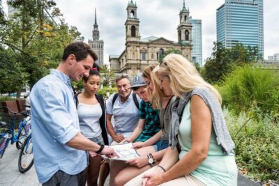
WWII turned the streets into evidence. This Amsterdam South bike tour connects occupation and resistance stories to what you see today, using wartime photos matched to each stop. I especially love the tiny group size (up to six) and the then-and-now photos that make each location feel immediate and specific.
The ride is about 2 hours 30 minutes to 3 hours 10 minutes, and it’s guided in English with mobile tickets, so you spend more time outside and less time coordinating. One consideration: it’s heavy, detailed WWII storytelling, and you’ll be cycling through multiple neighborhoods rather than taking a slow walk.
In This Review
- Key things that make this tour worth your time
- Cycling Through WWII Amsterdam South (and Why Bikes Work Here)
- Price and Time: What You’re Really Paying For
- Meeting at Tesselschadestraat, Then Riding Toward Victorieplein
- Victorieplein and June 20, 1943: Daniël Willinkplein Under Occupation
- Merwedeplein and Het Achterhuis: Frank Family Stories in Plain Sight
- Tilex Bar (Tilly and Lex): Lex van Weren’s Trumpet and Survival
- Cornelis Troostplein and the PBA Baracks: From Parish Life to Police Occupation
- Museumplein’s WWII Stronghold: Offices, Flak Batteries, and NSB HQ
- Roelof Hartplein: Coffee, Restrooms, and Resistance Photo Development
- Beethovenstraat/Apollolaan and Euterpestraat: Execution, Retaliation, and Fear
- Memlingstraat and Rubensstraat: SD-HQ Amsterdam and Stolen Possessions
- Olympiaplein and Parnassusweg: Registration After the June 1943 Raid
- Valeriusplein (Amsterdam Lyceum): Luftwaffe Headquarters at the End of Occupation
- Queen Emma’s Statue and May 7, 1945: Flowers, Surrender, and Last-Day Tensions
- Is This Tour Safe and Rider-Friendly?
- Emotional Tone: Expect Details, Not Just Dates
- Should You Book This Amsterdam WWII Bike Tour?
Key things that make this tour worth your time
- Up-close WWII locations in Amsterdam South, where bikes can reach streets cars can’t
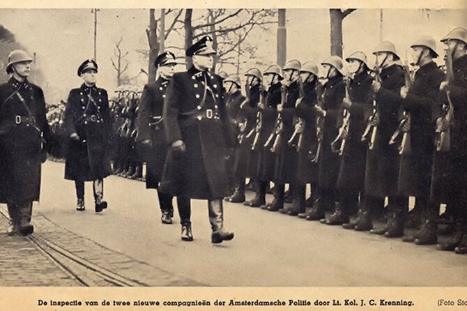
- Then-and-now photos at the exact stops, including what changed and what stayed
- Small group feel (max six) for better pacing and questions
- A real mix of stories, from arrests and deportations to resistance plans and retaliation
- A guided rhythm that covers lots of ground without turning your day into walking marathons
- A quick coffee and restroom stop around Roelof Hartplein to reset before the next stretch
Cycling Through WWII Amsterdam South (and Why Bikes Work Here)
Amsterdam’s WWII sites aren’t all in one neat museum cluster. This tour threads them through neighborhoods south of the center, and that matters because you get the street texture—brick, corners, squares—rather than just captions in a building.
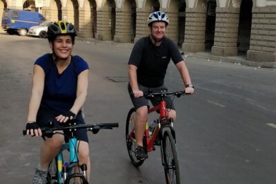
Cycling also changes how you process history. You’re moving through space the way the people of the 1940s did, past the same geometry of streets and storefronts, even when the buildings have changed. If you want more than “tour-bus history,” this format does a good job.
And because the group is small, the guide can slow down when something is complicated—like names, offices, or what a particular building was used for during the occupation. That’s a big deal when you’re dealing with arrests, deportations, and resistance efforts.
Price and Time: What You’re Really Paying For
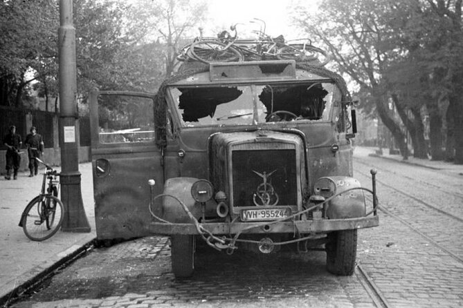
At about $66.09 per person for roughly 2 hours 30 minutes to 3 hours 10 minutes, the value comes from three things you can’t easily replicate on your own without research time:
First, you get guided context at each location—who used the site, what happened there, and how it connects to the bigger WWII story in Amsterdam. Second, you get paired wartime photos tied to your exact stopping points, which turns “I saw a plaque” into “I understood the scene.” Third, you cover more area by bike than you would on foot, especially since the tour is designed to reach quieter areas away from the most congested center.
Yes, it costs more than a free walking loop with a map. But you’re buying structure, historical interpretation, and the specific then-and-now visuals that make the city feel like a living archive.
Meeting at Tesselschadestraat, Then Riding Toward Victorieplein
You meet at Tesselschadestraat 1 (1054 ET, Amsterdam) at 11:00 am. The tour uses a mobile ticket, and it runs in English, with a maximum group size of six.
From there, you pedal toward the early stops connected to some of the most brutal episodes of the occupation. The pacing works best if you show up ready to ride—this isn’t a stop-and-stroll tour where you can drift at your own speed.
One practical upside of the small group: you’re not trying to read tiny text while ten other bikes funnel past you. The guide can keep you together, and you can actually hear what’s being explained.
Victorieplein and June 20, 1943: Daniël Willinkplein Under Occupation
Your ride begins at Victorieplein, which was called Daniël Willinkplein at the time. This is where the tour sets a dark baseline for everything that follows.
On June 20, 1943, a major raid took place in Amsterdam. Large groups of Jewish citizens were arrested during what the Nazis framed as a Judenaktion. Dutch police units (PBA, Police Battalion Amsterdam) and police volunteers from the NSB helped in the process. The Jews were transported—among other places—to Olympiaplein for registration, and then onward to Westerbork concentration camp in the east of the Netherlands.
Standing where today’s skyline and streets look normal, the contrast is the point. The story isn’t abstract here; it’s mapped to the city’s layout. If you’re the type who needs a reason behind the route, the tour gives you one from the first pedal.
Merwedeplein and Het Achterhuis: Frank Family Stories in Plain Sight
Next comes Merwedeplein 37-II (noting the building’s numbering system as it was in the past). This was home to the Frank family. In summer 1942, Otto Frank and his family (plus some acquaintances) moved to Het Achterhuis, the Secret Annex on the Prinsengracht, connected to Otto Frank’s work location.
A statue commemorates Anne Frank on Merwedeplein. Around the corner, the tour points you toward the Waalstraat bookstore Jimmink, which is still active today. It sold the first edition of Het Achterhuis (the diary’s story published later, with Contact publishers). Otto Frank bought the diary for his daughter at this bookstore.
This stop works well because it’s not only about what happened during the occupation—it’s also about what survived afterward. You’re reminded that personal artifacts (letters, books, diaries) can be the evidence that outlasts destroyed systems and burned files.
Tilex Bar (Tilly and Lex): Lex van Weren’s Trumpet and Survival
At Waalstraat 48, opposite Merwedeplein, the tour brings you to a place that’s now Café Blek, but was once the Tilex Bar (Tilly and Lex—van Weren). Lex van Weren survived Auschwitz because he had to play his trumpet at executions.
This stop is emotionally sharp. It’s also a useful reminder that WWII wasn’t only about “big events”—it was about coerced choices and how people were forced to perform under terror. The tour doesn’t treat it like a ghost story; it keeps it grounded in a specific individual and a specific fate.
If you prefer history in the shape of people (not just dates), this is one of the most gripping places to linger for a minute.
Cornelis Troostplein and the PBA Baracks: From Parish Life to Police Occupation
At Cornelis Troostplein 23, the tour points out the former PBA baracks. Before WWII, the area was known as a peace parish—an older Catholic complex with two convents and a school.
In spring 1942, the Sicherheitsdienst (SD) / Gestapo chief Rauter inspected the PBA and met Reichsführer-SS Heinrich Himmler at Museumplein. That detail matters: this wasn’t just street-level control. Senior Nazi leadership was actively orbiting these local infrastructures.
You end up seeing how occupation often reused existing institutions. It’s less about building something new and more about repurposing what was already there.
Museumplein’s WWII Stronghold: Offices, Flak Batteries, and NSB HQ
Museumplein is a major stop because the tour explains how the Germans turned the square into a stronghold. When you face the concert hall, the houses on the left were occupied by German offices.
The tour gives concrete examples: the former United States consulate building once housed the Zentralstelle für Jüdische Auswanderung (Central Jewish “Emigration” office). Next door you could find the Ortskommandantur (Town Major) and the Feldgendarmerie (Military Police) building, and other structures housed Nazi party offices and German services.
On the square in front was the IJsclubterrein (Amsterdam skating club). Here, the Germans built bunkers and anti-aircraft (Flak) batteries. Near the concert hall was the NSB HQ Amsterdam. After WWII, the bunkers were blown up.
This is where the tour really earns its structure. You’re standing near a place that looks open and public now, but the guide walks you through how it functioned as an operational command node during the war. It helps you understand why certain neighborhoods feel different once you know what was hidden behind everyday façades.
Roelof Hartplein: Coffee, Restrooms, and Resistance Photo Development
Roelof Hartplein includes a short break: Cafe Wildschut for coffee and a restroom visit. It’s about 10 minutes.
Then the tour moves into a clever detail: there was a photo shop next to the library building on Roelof Hartstraat. During the war, the Dutch resistance used the store and developed unique photos—like images connected to the first roundup of Jews in Amsterdam by the SD/Gestapo and German order police (including Charles Breijer).
The tour also points out a small monument remembering Jews taken from this neighborhood. So you get a pause that’s practical, but the stop still ties directly back to resistance infrastructure—how even photography and printing could serve as evidence and warning.
Beethovenstraat/Apollolaan and Euterpestraat: Execution, Retaliation, and Fear
At the corner of Beethovenstraat and Apollolaan (noting the house numbers still match much as during WWII), the tour describes late-October 1944 events.
Herbert Oelschlägel, an SS officer and SD/Gestapo agent, was executed by a Dutch resistance member around in front of house number 6. In retaliation, the SD/Gestapo burned down two houses and executed 29 resistance fighters.
The tour adds a timeline hook by explaining the street was called Euterpestraat at the time. It also points you toward Gerrit van der Veen, who led an important Dutch resistance group.
This stop is useful because it shows the occupation’s logic: one act by the resistance triggered collective punishment. It’s grim, but it helps you understand why secrecy and risk mattered so much.
Memlingstraat and Rubensstraat: SD-HQ Amsterdam and Stolen Possessions
At Memlingstraat/Rubensstraat, the tour points to two offices central to Nazi oppression. One was SD-HQ Amsterdam, an SD Außenstelle under Willy Lages. The other was the Hausraterfassungsstelle, which dealt with stealing the possessions of deported Jews. That unit was part of the Zentralstelle für Jüdische Auswanderung, and the leader mentioned by the tour was a Dutch collaborator named Henneicke.
Then comes the resistance angle: in November 1944, the resistance requested the Royal Air Force via a secret radio message to attack the headquarters of the SD/Gestapo and the Hausraterfassungsstelle, with the main aim of destroying SD/Gestapo files. The tour notes this job was done by Group Captain Denys Gillam DSO, DFC, AFC, leader of 149 (Typhoon) wing.
The stop also references a resistance safehouse at Rubensstraat/Gerrit van der Veenstraat and points you to Stolperstein (the stumbling stones) for the address. It adds that the safehouse address was betrayed in June 1944 by a female informant known as V-Frau.
Even if you’ve heard parts of WWII before, this is the kind of stop that makes it coherent. You see the system: offices, files, stolen assets, and the information war around them.
Olympiaplein and Parnassusweg: Registration After the June 1943 Raid
At Olympiaplein/Parnassusweg, the tour ties back to the June 1943 raid. Jewish people arrested during the June 1943 raid at the sports complex were registered by the SD/Gestapo with help—shocking help—of Jewish camp police sent from Westerbork concentration camp.
That detail is hard to process, but it’s historically important. It shows how the Nazi system worked by using coercion and forced roles, turning victim communities into tools of the machinery.
If you’re wondering why the route keeps connecting raids, offices, and transport points, this stop is one of the “glue” locations. It links the violence to the paperwork and procedures that made deportation function.
Valeriusplein (Amsterdam Lyceum): Luftwaffe Headquarters at the End of Occupation
At Valeriusplein / Amsterdam Lyceum, the tour explains the school building was headquarters of the Luftwaffe at the end of the occupation.
This is a good stop for anyone who’s used to thinking of military power as marching troops. Here, it’s paperwork, communications, and control happening inside an ordinary-looking building type—a school.
And because you’re cycling between neighborhoods, the tour helps you compare the same architectural style across different functions. That’s one of the quiet lessons of the day.
Queen Emma’s Statue and May 7, 1945: Flowers, Surrender, and Last-Day Tensions
The tour includes a stop at the Statue of Queen Emma on Emmalaan/Prins Hendriklaan. In summer 1940, people placed flowers at the statue in defiance of the German occupiers.
That’s a lighter-feeling moment, but still loaded. It’s resistance as visible public action—small, direct, and risky.
Finally, the tour addresses the end of the war. When the Germans surrendered on May 7, 1945, dangerous situations arose between frustrated German troops and resistance fighters. The tour points out a monument to victims of one of the shootings on the last day. It ends by guiding you through Vondelpark back to Leidseplein, where you started the route.
That closing matters. The occupation ends, but the story doesn’t instantly turn into neat closure. The tour keeps your perspective honest about how liberation can still be chaotic on the ground.
Is This Tour Safe and Rider-Friendly?
The tour is structured as an actively guided bike route, and the overall feedback emphasizes safe navigation and clear guidance. Since the group is capped at six, you can expect a calmer ride than on large, chaotic cycling excursions.
That said, you should be comfortable riding a bike for multiple kilometers at a steady pace, with stops built into the route. If you’re new to cycling or easily overwhelmed, you’ll want to assess your comfort level before you commit.
Emotional Tone: Expect Details, Not Just Dates
This experience spends real time on arrests, deportations, retaliation, and how Nazi systems functioned through offices and files. It’s not just a list of names and years.
The upside is clarity: the guide connects what you’re seeing to what was happening there. The paired wartime photos also reduce confusion, because you can compare today’s street to the occupied-era scene.
Should You Book This Amsterdam WWII Bike Tour?
Book it if you want WWII history you can touch—on sidewalks, in squares, outside buildings that now look ordinary. The small group size, the car-avoiding bike route in Amsterdam South, and the then-and-now photos are the big wins that make this feel more like a guided walk through a real-time timeline than a generic lecture.
Skip it if you want light, entertainment-first sightseeing. This route is serious, and you’ll be cycling while listening to difficult stories.
If your idea of a great Amsterdam day includes quiet neighborhoods, exact-location photo evidence, and a guide who can explain what each site was used for—Rudy (and sometimes Peter) is exactly the type of host you’ll appreciate.